![Cycling Sassafras Mountain, South Carolina Cycling Sassafras Mountain, South Carolina - compass at climb summit, North Carolina/South Carolina border]()
Cycling Sassafras Mountain, South Carolina
Ride 4.7 miles gaining 1,842’ at 7% average grade.
Photo: Observation platform at top of climb, the black line is NC/SC border
7% doesn’t sound too bad, right? Think again!! This climb has multiple 20+% short segments and a full quarter-mile that averages nearly 17%.
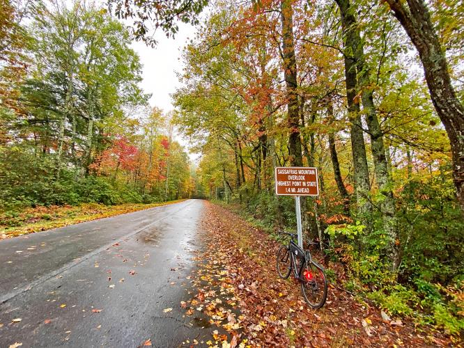
Aside from the torture of the several short terribly steep stretches, this climb is very pleasant. We are surrounded by forest the entire climb which is gorgeous during fall colors. There is also an observation platform on the border of North and South Carolina that doubles as South Carolina’s highest point.
![Cycling Sassafras Mountain, South Carolina Cycling Sassafras Mountain, South Carolina - photo collage, Garmin Device reads 24%, sign reads "Sassafras Mountain Overlook, Highest point in the State", PJAMM Cyclist standing at staircase at climb's summit, PJAMM Cycling logo in corner]()
“Likely the most difficult climb in South Carolina, Sassafras Mountain is a bit isolated but well worth the effort to get there. From the road junction, a shallow start leads through thick woods and the road carries little traffic most of the time. The grade is quite variable on this hill as you encounter several double digit grade sections as well as a few flats and descents along the way which significantly lessen its average grade. Around one mile into the ascent, a severe stretch of road contains the maximum grade on the hill. Soon after, the route descends, climbs briefly and then descends again before returning to uphill. At mile 3.7 turn right to continue to climb over poor pavement (as of 2011). Soon you find yourself on another extended stretch of challenging and double digit grade. After a half mile the slope then eases and then steepens one last time over the final section to the top where the listed climb ends at the gravel parking lot with hiking possibilities.” (This quote is provided with the approval of John Summerson from his book, The Complete Guide to Climbing (by Bike), 2nd Edition, pg. 114.)
![Cycling Sassafras Mountain, South Carolina Cycling Sassafras Mountain, South Carolina - climb start, sign for Sassafras Mountain Wildlife Viewing Area]()
The climb begins by riding north up Van Clayton Memorial Highway from its T intersection with Route 178.
![Cycling Sassafras Mountain, South Carolina Cycling Sassafras Mountain, South Carolina - bike parked next to stone sign that looks like headstone which reads in part "F. Van Clayton Memorial Highway, Honoring him for a life of service to his community and state..."]()
![Cycling Sassafras Mountain, South Carolina Cycling Sassafras Mountain, South Carolina - PJAMM Adventure app shows climb grade and profile]()
PJAMM Adventure App showing stats at climb start.
![Cycling Sassafras Mountain, South Carolina Cycling Sassafras Mountain, South Carolina - wet, two-lane roadway surrounded by dense forestation, misty air, PJAMM Cycling logo in corner]()
We are surrounded by forest the entire climb.
![Cycling Sassafras Mountain, South Carolina Cycling Sassafras Mountain, South Carolina - bike parked at road sign at mile 3, road surrounded by dense forestation]()
Mile 3
![Cycling Sassafras Mountain, South Carolina Cycling Sassafras Mountain, South Carolina - bike parked next to closed gate with sign for "No Bikes", informational signage]()
End of the bike ride -- on foot for 100 yards from here.
![Cycling Sassafras Mountain, South Carolina Cycling Sassafras Mountain, South Carolina - observation tower at climb's summit, large compass]()
Observation tower at the Mount Sassafras Summit.
![Cycling Sassafras Mountain, South Carolina Cycling Sassafras Mountain, South Carolina - bike parked along North and South Carolina Border on compass]()
The North/South Carolina border runs down the middle of the observation tower.

 We've partnered with Sherpa-Map.com to bring you the best route planning tool. With a PRO Membership you can use this climb as a reference when creating your route.


